Kalahari Camp Maps
On this page you will find all the Kalahari Camp maps (Kgalagadi Transfrontier Park camp maps).
We don't want to duplicate what SANParks has on their web site but many visitors have requested all the maps on one page so here they are.
In addition to these maps, we have more hints and tips on the
Camps and Bungalows, which camps are the best to
photograph from and which camps are good for
night photography.
Just click on each thumbnail below and the Camp Maps will open in another window...
|
|
|
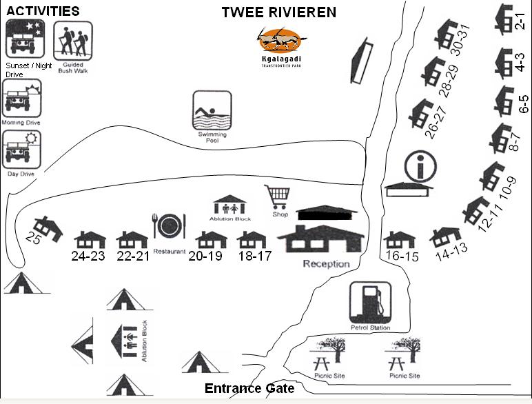
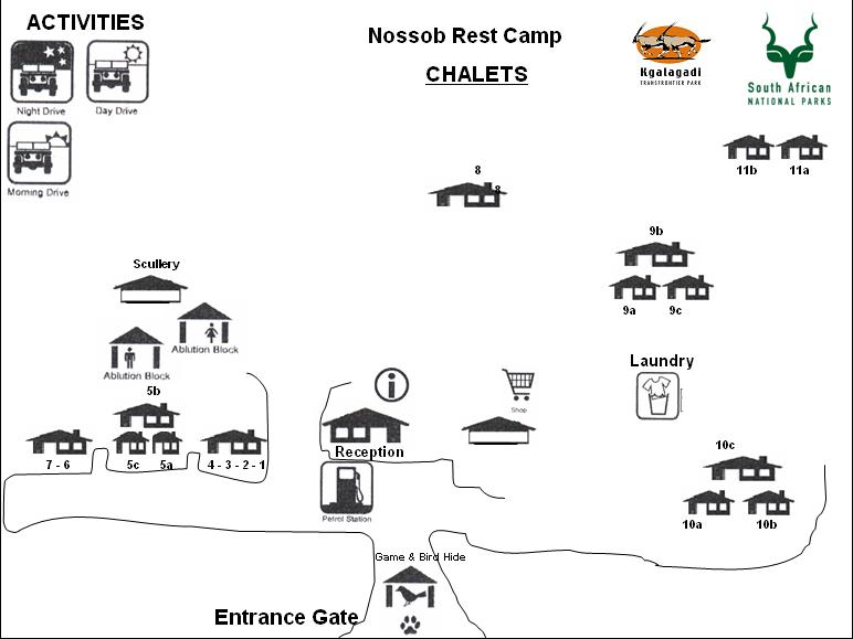
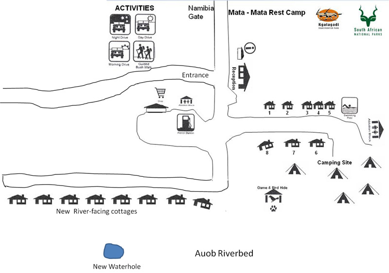
| Twee Rivieren | Nossob | Mata Mata |
We have updated the Mata Mata camp map to show the new camp layout containing the eight new river-facing chalets and the new location of the waterhole.
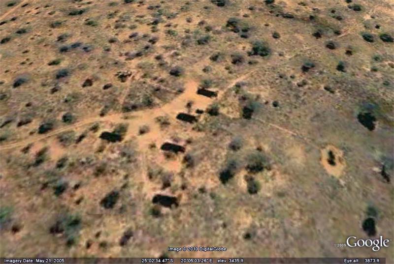
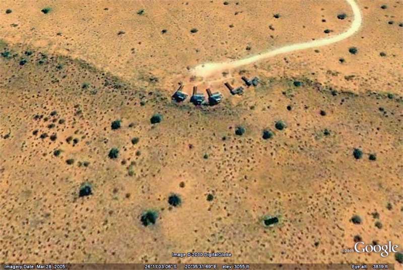
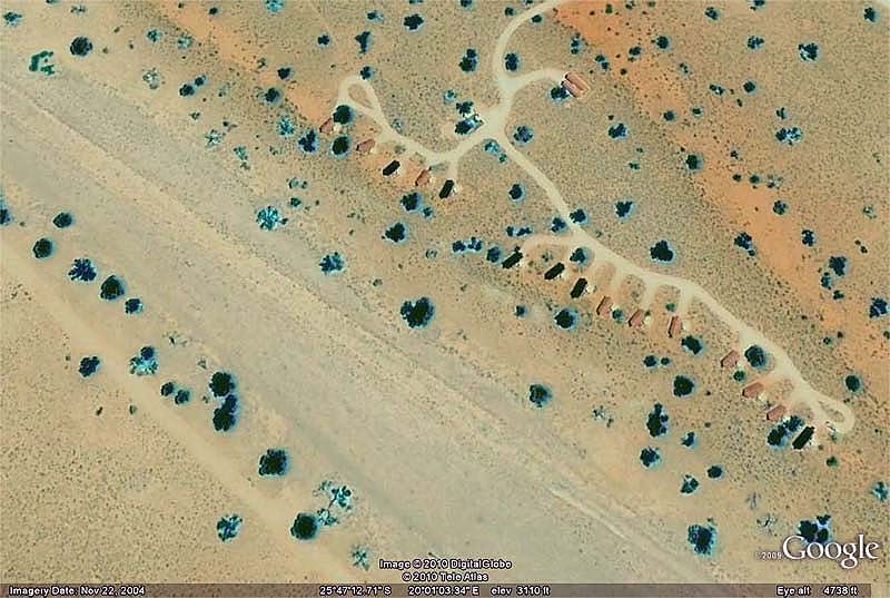
There are no official maps available for the Wilderness Camps so we have included aerial views from Google Maps of the three wilderness camps that have clear satellite pictures...
|
|
|
| Gharagab | Kieliekrankie | Kalahari Tented Camp |
The Google maps for the wilderness camps of Bitterpan, Grootkolk and Urikaruus are not good quality but when this changes we will update this page with the higher quality aerial camp layouts.
To download a high resolution map of the Kgalagadi Transfrontier Park that shows all the main camps, wilderness camps, tourist roads, 4x4 tracks, picnic sites, and waterholes, please click on the following image...

All camp maps © SANParks.org.
Kgalagadi Transfrontier Park map © Findtripinfo.com and Kruger-2-Kalahari.com
All aerial photographs © Google.
Return from Kalahari Camp Maps to Kruger-2-Kalahari Home Page

 Subscribe To This Site


To make a safari rental booking in South Africa, Botswana or Namibia click here
"This eBook is packed with knowledge that can be applied to other parks, safaris and wildlife excursions via the photography lessons and additional advice for photographers" - Amanda Ellis, Pretoria, South Africa
"This eBook will be extremely useful for a wide spectrum of photography enthusiasts, from beginners to even professional photographers." - Tobie Oosthuizen, Pretoria, South Africa
"Having a passion for the region myself and having had to learn about all the dynamics, waterholes and ideal routes to drive over a period of 6 years - I wish I had this guide on my first trip already!" - Morkel Erasmus, Secunda, South Africa
"Mario and Jenny take you to spots that are not always visited, and their descriptions of the more remote camps will allow you to make an informed decision without wasting time and money" - Bob & Sherry Shepardson, DeBary, Florida, USA
Photo Safaris on a Private Vehicle - just You, the guide & the animals!
New! Comments
Have your say about what you just read! Please leave us a comment in the box below.